British Camp Hill Fort Walk
| Overview | |
|---|---|
Difficulty: | Medium |
Distance: | 3.4 miles / 5.4 km |
Terrain Type: | Hiking trails, rocky terrain, stone paths |
Starts From: | British Camp Car Park, A449, Great Malvern, Malvern, WR13 6DW |
Closest Vet: | |

Nestled in the picturesque Malvern Hills, British Camp Hill Fort offers a serene and historic backdrop for a leisurely stroll with your four-legged companion. Whether you’re a local looking for a new adventure or a visitor seeking a unique experience, this ancient hill fort promises breathtaking views, rich history, and the perfect environment for a refreshing walk with your dog.
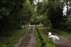
The best place to start is from the British Camp Car Park off of the A449. If you’re coming in from Little Malvern, it’s just on the left hand side as you go around the bend leading up the hill. It’s a large car park so you shouldn’t struggle to find a space. It’s pay and display so you’ll need to buy a ticket. At the time of writing, the only option was to buy an all day ticket for £5.25. With this in mind, it’s probably not worth it if you’re only planning on walking for about half an hour.
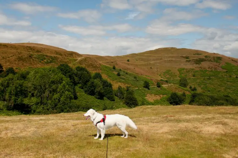
British Camp
There are three paths off of the car park. There’s one right at the bottom end of the lower car park, one about halfway down the car park on the right hand side, and one at the the top of the car park on the main road. We started from the exit by the main road. Once you’re on the path from here, you can take either the second or third right turn, both of which head up the bank. Either of these will bring you to the main path that leads straight up to British Camp Hill Fort.
As you go along the path towards the summit (also known as the Herefordshire Beacon), there are several interlinking paths criss-crossing the hill that can be explored. These pathways, especially those running around the circumference of the hill, are a reminder of the site’s history.
It’s unknown exactly when the site was first settled, but the original hill fort that encompassed the summit is thought to have been constructed in either the late Bronze Age or the early Iron Age. The fort was extended in the middle Iron Age to include the spurs to the south and north-east of the Beacon. It was abandoned at some point after the arrival of the Romans, but later became the site of a ringwork and bailey castle in the medieval period. If you’re interested in learning more about the history of the site, you can read the report from the English Heritage archaeological survey here.
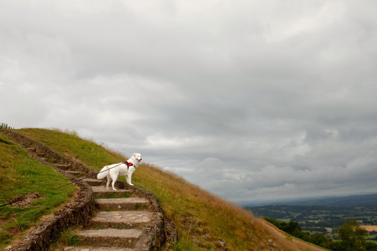
Millennium Hill and Hangman's Hill
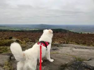
Once you’ve reached the summit, you’ll want to head south towards Millennium Hill. This is the next hill along in the chain that make up the Malvern Hills. At 321m high, it’s only just shorter than British Camp (338m), but the views are no less stunning. From here, we started heading south-east towards Hangman’s Hill.
This next peak gets its name from its grisly history. In the 13th century, the local lord constructed a gibbet on the top of the hill. This hill is also home to the Giant’s Cave (also known as Clutter’s Cave), which has a mysterious background. Some believe it originated as a medieval hermit’s cave, but it may have been built as a 19th century grotto for the neighbouring Eastnor Estate. A local legend states that a jealous giant ripped a stone out of the side of the hill to throw at his adulterous wife, leaving the cave you see today (I think this explanation can be safely ruled out).
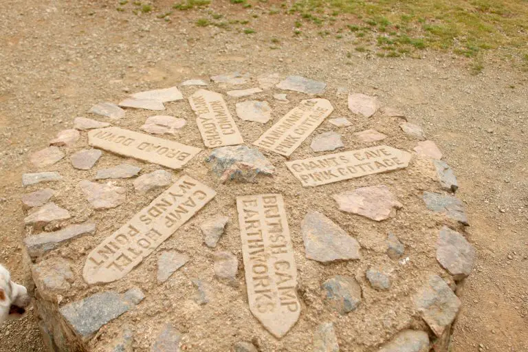
Shire Ditch and Swinyard Hill
After Hangman’s Hill, we headed south again until the path forked into two. We turned right and then headed left once we hit the next T-junction. From here we followed this path south to Swinyard Hill. This 237m hill is the last we visited on this route. We did actually venture a little further south (as you can see from the Komoot map), but we soon decided to head back as the heat was starting to get too much at this point in the day.
For the return leg, we headed back north from Swinyard Hill along the path we’d originally come down. This track is actually part of the historic Shire Ditch. This used to be a fortified boundary, dividing the territory of the 13th century lord Gilbert de Clare and his neighbour, the Bishop of Herefordshire.
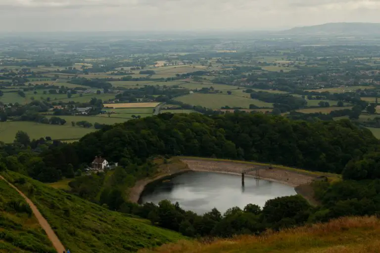
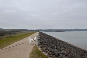
From here, we retraced our steps all the way back to Hangman’s Hill. Rather than head back up Millenium Hill though, we headed north along the path that runs along the right hand side of the hills, closer to British Camp Reservoir. Keep following this path and you will eventually end up at the lower end of the car park.
Dog Friendly Places To Eat Near British Camp
The obvious choice for food and drink after your walk is the Malvern Hills Hotel, which is literally over the road from the car park. Dogs are welcome outside and in the Oak Lounge bar area. We opted to have lunch here and ended up getting a seat in the outdoor Secret Gin Garden, which was a quieter spot towards the back of the hotel grounds.
Another nearby option is The Wellington Inn, which is on the A449 heading west towards Massington. This real ale pub has plenty of outdoor seating, as well as biscuits and water for any canine visitors.
If you’re after something a bit different, check out the Marlbank Inn in neighbouring Welland. This dog friendly gastropub is known as one of the best purveyors of authentic Indian cuisine in the area. They also have their own campsite if you’re interested in stopping in the area. Their website boldly claims that they serve the best pint of Guinness in all of Worcester, which is a theory that’s definitely worth testing if you ask me!
More Like This...
Rudyard Lake Walk
This gentle route around Staffordshire's Rudyard Lake is perfect for a sunny weekend walk with...
Middle Black Clough Waterfall Walk
This short but rewarding walk in the Peak District is well worth it for the...
Bosley Cloud Walk
You will enjoy stunning views of the Cheshire countryside on this concise route, as well...
Carsington Water Reservoir Walk
This Derbyshire trail takes you all the way around the edge of Carsington Water. Along...