Lud's Church And The Roaches Walk
| Overview | |
|---|---|
Difficulty: | Hard |
Distance: | 7.9 miles / 12.7 kilometres |
Terrain Type: | Dirt trails, hiking paths, tarmac road, field. Some downhill scrambling required on the Roaches. |
Starts From: | Gradbach Car Park, Buxton, SK17 0SU |
Closest Vet: | |
Introduction
You’ll get to experience two of the best spots that North Staffordshire has to offer on this Peak District route. First up is a journey through the atmospheric chasm of Lud’s Church. Once you’ve emerged from the depths, you’ll climb to the top of the Roaches and take in the panoramic views as you stroll along the rocky ridge. The second half of the route goes along the hillside behind the Roaches before dropping into the gorgeous Back Forest.
We started this walk from Gradbach Car Park, which can be accessed by taking the Brown Lane turning off the A53. Follow the road into Flash, then turn left just after the church onto New Road. Keep going until you see Gradbach Mill Lane on your left. Go down it and the car park will be on your right.
It’s free and has room for about 20 cars. It’s popular due to it’s proximity to Lud’s Church, so make sure you get there early to have the best chance of snagging a spot. If you can’t get a space here, carry on down the lane then turn left up the hill. There’s additional parking here but you’ll have to pay a small fee.
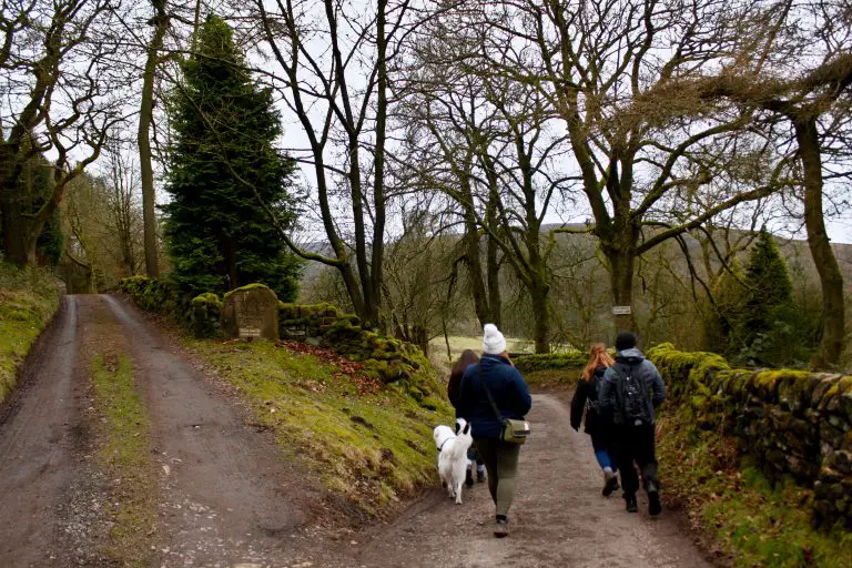
Dog’s don’t have to be kept on a lead for this route. It’s a popular trail though, so there will be a lot of other people and dogs about especially during the summer months.
Gradbach
To begin, we turned right out of the car park entrance and followed Gradbach Mill Lane. After around 300m the path forks, with the lane leading to the Mill going off to the right. If you’re doing this walk between Easter and October, the Riverside Cafe at Gradbach Mill is just down this lane. They serve snacks and refreshments every day between 10am and 4pm if you want to fuel up for the walk ahead.
We did this route in February so we carried on down the left hand path at the fork instead. Keep heading down this track, going past the entrance to the Scout Camp on your right. Once you’re past the scout camp, take the right hand path and then keep right as you go down the bank. It’s pretty well signposted as to which paths go to Lud’s Church and which ones are private drives, so it’s hard to get lost. You’ll hit a short but fairly steep descent as the path veers off to the right, which brings you to a small bridge crossing the stream.
Once you’re over the bridge, go straight on at the crossroads up the path leading up the hillside. Eventually you’ll come to a T-junction; you’ll turn right here and follow the track as it slowly winds around the side of the hill. This leads you to a large rocky outcrop (which was being used as a launch pad for drones when we visited). At this point the path almost doubles back on itself and heads in an easterly direction.
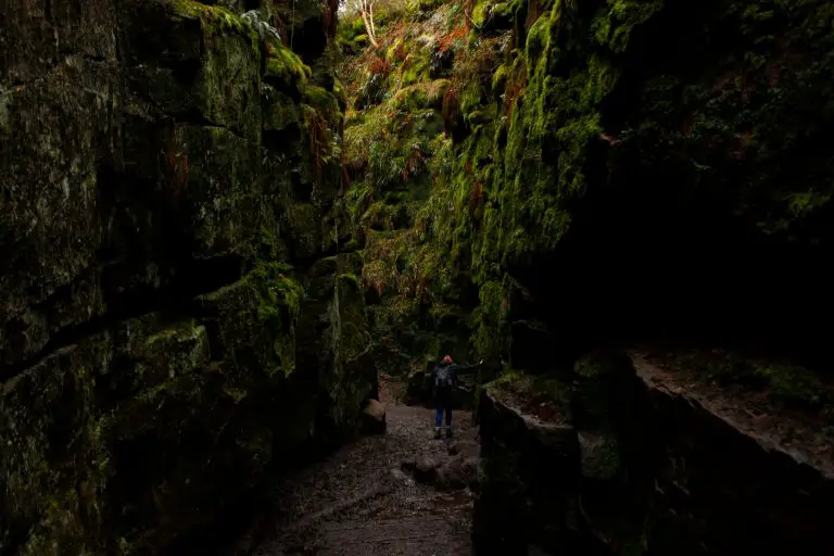
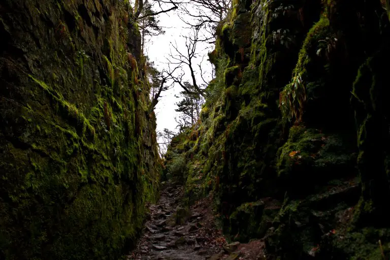
Lud's Church
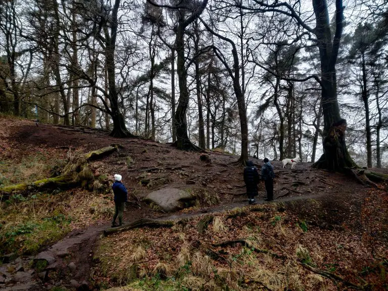
Not far along this track is the entrance to Lud’s Church. This 18m deep chasm was formed by a huge post-glacial landslip, where everything but the upper third of the hillside has slipped down towards the River Dane. Unsurprisingly, this unique location has a storied history. In the early 1400s, the persecuted Christian sect the Lollards used Lud’s Church as a secret meeting place for worship. Some scholars theorise that the Church was the inspiration for The Green Chapel, where the Arthurian knight Sir Gawain had his final encounter with the legendary Green Knight.
It’s easy to see why they think this – even in the depths of winter the chasm is a vibrant green colour, thanks to all the moss that clings to the side of rock faces. You’ll need some decent walking boots or wellies for this as it can be quite steep and uneven when you’re heading down through the rift. It’s also extremely boggy at the bottom if you visit in the winter like we did. The mud is so deep that at some points you’ll be walking over planks and thick tree branches instead of the path.
After about 100m you’ll emerge from the chasm back into the woodland. From here, follow the path over the wooden boards until you hit a T-junction. Take the path going right that leads out of the woods onto the open heathland, going up the hill. After roughly 200m, turn left at the crossroads and you’ll see the Roaches in front of you. To get there, just follow the track you’re on until you reach a narrow gap in the dry-stone wall in front of you that brings you out onto a tarmac road.
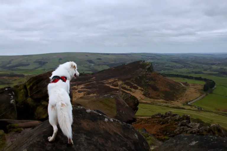
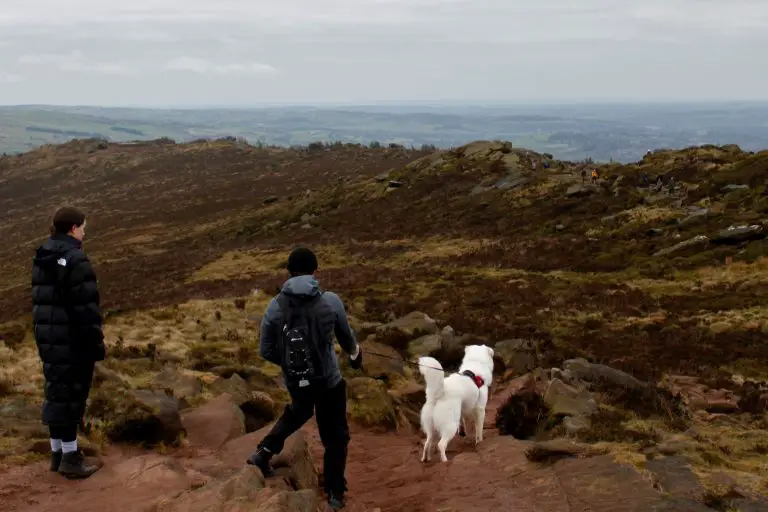
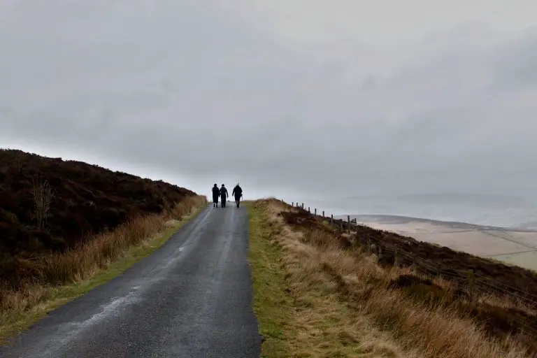
The Roaches
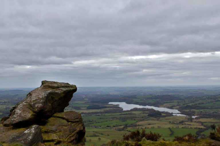
Once you’ve reached the road, cross straight over it and start heading up the paved pathway going the hill. You’re now on the rocky ridgeline known as the Roaches, and you’ll stay on the main pathway for about 2.5km. You can enjoy some staggering views from up here, where you’ll be able to see Tittesworth Reservoir, Bosley Cloud and Jodrell Bank. Some say that you can even see Snowdon if it’s clear enough (we did not).
While it is beautiful up here, this isn’t a great route if you’re after some solitude. We went on a cold February morning, and there were still lots of hikers and runners about. If your dog is particularly reactive, be warned that you will bump into plenty of other dogs on this section of the walk, many of them off the lead.
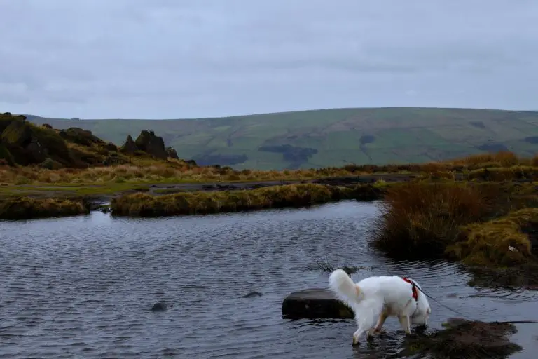
About 2km along the ridge, you’ll come across a small body of water called Doxey Pool. While it may seem idyllic, legend has it that it is inhabited by a mermaid who lures unsuspecting victims to a watery grave. We didn’t see a mermaid so we think you’ll be alright, but bring a snorkel and a towel if you’d prefer to err on the side of caution.
At the end of the ridge, we went off the beaten track and ended up scrambling down the rocks until we rejoined the path down below. I’d love to say that this was purely down to our innate desire to explore, but to be honest it came about from being so busy nattering that we lost the trail. If you want to stick to the path, keep to the right hand side of the ridge.
Whichever way you leave the Roaches, head down the track across the field to the wall in front of you, then follow the path off to the left once you hit the wall. As the path curves around to the left, you should have Ramshaw Rocks on your right, Hen Cloud behind you, and the Roaches on your left.
After about 800m, go over the stile off the field and onto a gravelled lane. 300m later there will be another stile on your left. Head over it onto the field, then follow the public footpath through the fields over a succession of stiles. Again, this section can get very boggy in parts so good footwear is a necessity.
You’ll then pass a farm on your left – follow the footpath onto the driveway which then leads you to Hazelwood Road. Turn left here and continue uphill along the main road for 2km. Although it’s road walking, there is a grass verge you can walk along and some great views over to your right hand side. The road is long and straight so you’ll have plenty of notice of any cars coming past. Eventually, you’ll end up at the crossing point where we first stepped onto the Roaches. Go through the narrow gap in the dry stone wall again but turn immediately right after doing so.
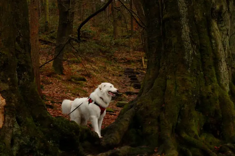
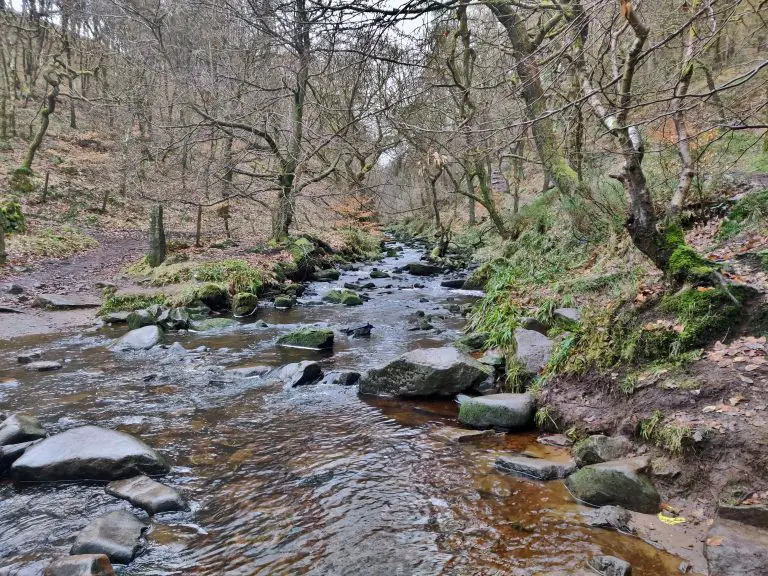
Back Forest
Follow the path down the hill and after 100m or so you’ll head into Back Forest. Shortly after entering, you’ll hit a clearing with paths leading off in different directions. If you want to revisit Lud’s Church, take the left hand path. We opted to go right, which takes you down the hill towards Black Brook.
This scenic stretch takes about 20-30 minutes and is relatively quiet compared to other sections of this route. Towards the end of this bit you’ll be right by the water’s edge, and there’s a little clearing which is a great spot for your dog to splash around in.
Eventually, you’ll come to the small bridge we crossed at the start of this route. Once you’ve crossed this bridge, you just need to retrace your steps to get back to the car park.
What To Do After
There’s no shortage of dog friendly options for food and drink in this neck of the woods. The Roaches Tea Room and Restaurant on Roach Road offers light bites with a stunning view of the countryside below. Heading a bit further out, the Lazy Trout at Meerbrook is always very popular with dog walkers coming from both the Roaches and the neighbouring Tittesworth Reservoir.
Our favourite place for a post-walk meal though is The Reform Inn in nearby Thorncliffe, where dogs are welcome in the bar area of the pub. The staff here are great and the food is always fantastic, so we’d wholeheartedly recommend popping in if you’re in the area.
More Like This...
Edale and Crowden Clough Walk
You'll go off the beaten path on this challenging but extremely rewarding Peak District dog...
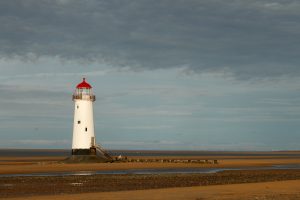
Talacre and Prestatyn Walk
This lengthy circular on the Welsh coast gives you a bit of everything - there's...
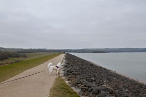
Carsington Water Reservoir Walk
This Derbyshire trail takes you all the way around the edge of Carsington Water. Along...
Long Mynd Loop from Church Stretton
This 11.6km circular takes you right into the heart of the Long Mynd in the...