Talacre and Prestatyn Walk
| Overview | |
|---|---|
Difficulty: | Medium |
Distance: | 12.6 miles / 20.2 kilometres |
Terrain Type: | Dirt trails, hiking paths, tarmac road, sandy beach. Route climbs for first 7km, with some steep sections, then descends for the next 4km. Last half of the route is flat. |
Starts From: | The Point Bar and Restaurant, 36 Station Road, Talacre, CH8 9RP |
Closest Vet: | |
Introduction
This lengthy circular on the Welsh coast gives you a bit of everything – there’s rolling hills, charming woodland and sandy beaches to enjoy on this walk. It starts from the beach end of Station Road in Talacre. To get to the starting point, you’ll want to get on the A548 and follow it until you hit the roundabout at Talacre. Take the exit onto Station Road and follow the road over the railway line until you reach the shops and restaurants at the end of the road.
At the time of writing, the beach car park at the end of this road was closed. We parked on the Point Bar car park instead, and paid £3 for all day parking (we visited in February, different charges may apply in summer). Alternatively, you can turn left off Station Road and park on Gamfa Wen car park.
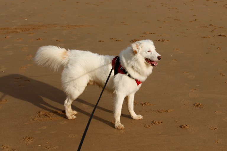
Dogs can be off the lead for the majority of this walk. Some sections though will require them to be on a leash. This is a long walk with some parts where you’ll be quite isolated, so make sure to bring plenty of water for everyone!
Talacre
Start your journey by following Station Road inland. You’ll cross over the railway line and eventually hit the roundabout linking Station Road with the A458. Turn right onto the A458 and cross the road so that you’re on the left hand pavement. After approximately 100m, turn left onto New Road and follow it up the bank.
As the road winds around to the left, you’ll see the entrance to Seaview Holiday Home Park. Go through the entrance and follow the road running along the front of the park before taking the third left. Just after turning left, look to your right for a grass pathway with a public footpath sign that runs in front of a row of caravans. At the end of this path is a gate that takes you out of the caravan park and onto a field.
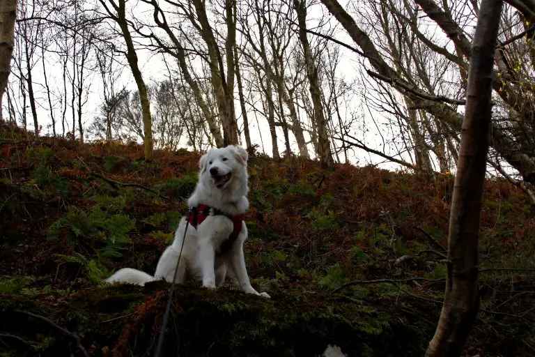
The public right of way runs along the right-hand side of the field next to a dry stone wall. You might notice that there’s an opening in the wall part way along. The opening leads into the woodlands in the private grounds of the grand Talacre Abbey. If you were to accidently go through the opening, we’d advise turning around and rejoining the main path. Otherwise you might stumble upon an extremely cool/sinister 19th century grotto, complete with tunnels, graves, and shell encrusted interior walls.
Back on the public footpath, continue walking until you hit the gate in the corner that takes you onto Abbey Drive. Follow Abbey Drive as it leads into the village of Upper Gronant, then turn right at the T-junction. Cross the road then turn left up Nant Y Crai Lane.
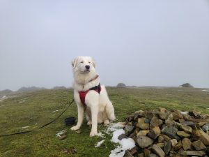
Upper Gronant to Gwaenysgor
After turning left onto Nant Y Crai Lane, you’ll follow it up the hillside for about 2km, but not before apologizing in advance to your thighs for what you’re about to put them through. You’ll climb 200m up a solid 10% gradient along this stretch. Admire the amazing sea views while you’re getting your breath back towards the top.
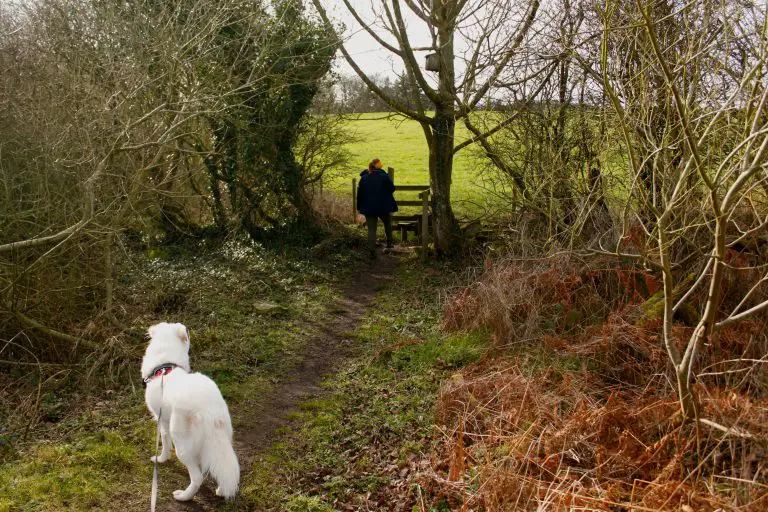
You’ll eventually hit a fork in the road. Keep to the left here, then turn right 350 metres later onto a field. Continue following the public footpath as it cuts through the middle of the field and goes over a few stiles.
You’ll then hit a a cross roads, with a gravelled road cutting across you. Turn left onto this road and follow it for 1.2km as it takes you into the heart of Gwaenysgor village, enjoying the sweeping views of the Welsh countryside as you go.
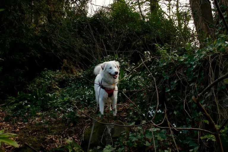
When we did this section of the route, there were several loud bangs that sounded like gunshots emanating from one of the neighbouring farms. These spooked Flynn to the point where I had to carry him for a short while as he was too scared to walk any further. I’ve no idea if this is something that happens regularly here, but it’s something to bear in mind if your dog is particularly skittish.
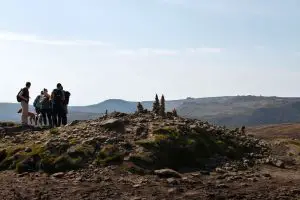
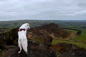
Prestatyn Hills
The track will eventually lead you to a T-junction with a main road in Gwaenysgor village. Turn right here, then cross the road and turn left down Well Lane. Continue along Well Lane as it takes you out of the village and onto the public footpath running up to the hill in front of you. On this climb up the mound, you’ll have to keep your dogs on a lead due to cattle being present (they weren’t there when we visited, but there was plenty of evidence that they had been there). You’ll also need to stick to the footpath and not journey up to the summit, as this is private land.
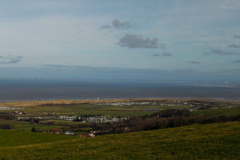
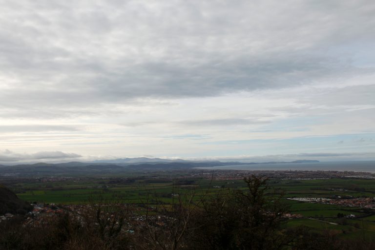
Once you reach the end of the track, turn right onto the trail leading along the edge of the hill. You can enjoy some great views of Prestatyn along this stretch. Be warned though, it’s a narrow path with a steep drop to your left and a steep uphill bank to your right. This makes it awkward when crossing people who are coming from the other direction.
This open section soon gives way though to some wooden steps with a handrail. Descend the steps until you reach the tarmac road at the end. Turn left, then follow the road as it curves round sharply to the right and joins Bishopswood Road.
Prestatyn
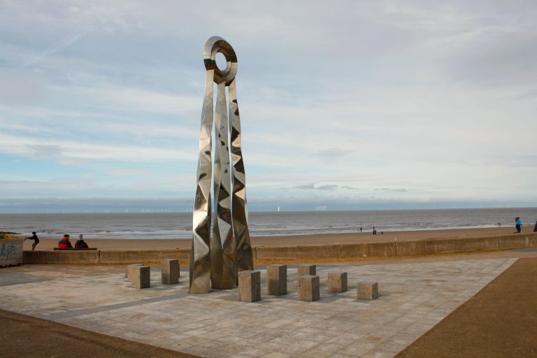
Just before the road turns left onto Fforddlas, be sure to check out the massive Roman Helmet sculpture in the park on the right hand side of the road. There are also some buildings to explore further up the hill if you fancy.
At the end of this road, you’ll come to a sort of crossroads. If you need a half time pint, the dog-friendly Cross Foxes pub is just on your left. Afterwards, cross the main road using the crossing on your right, then head left for a minute until you reach the High Street.
Head down the High Street into the town centre until you reach the train station. You can cross over the railway line by using the bridge, which can be accessed by either steps or a ramp. Once you’re down the steps on the other side, you’ll want to head straight and follow Bastion Road for just under 1km until you reach the sea front.
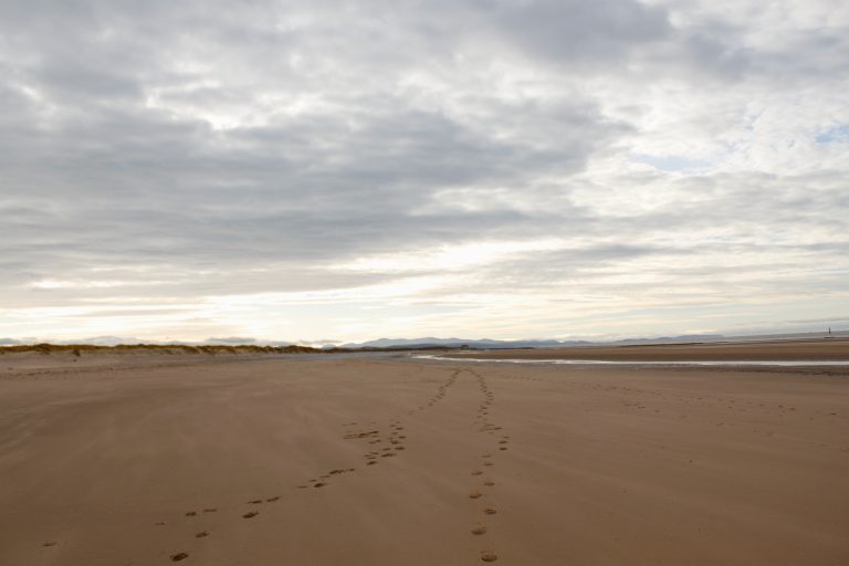
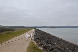
Talacre Beach
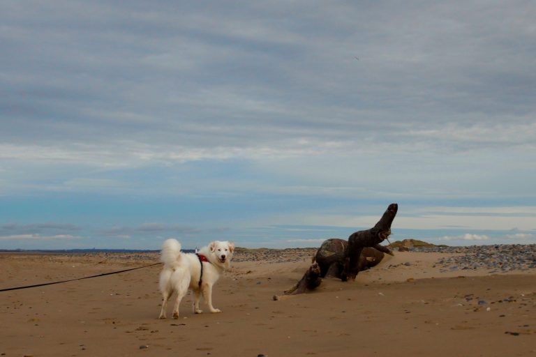
From here, you’ll turn right to head back towards Talacre. You can either follow the paved coastal path or walk along the beach. We chose to walk along the beach as the tide was out when we reached this point. You’re welcome to have your dogs off the lead here. The middle section of coastline barely had anyone on it when we went, although we did visit in February.
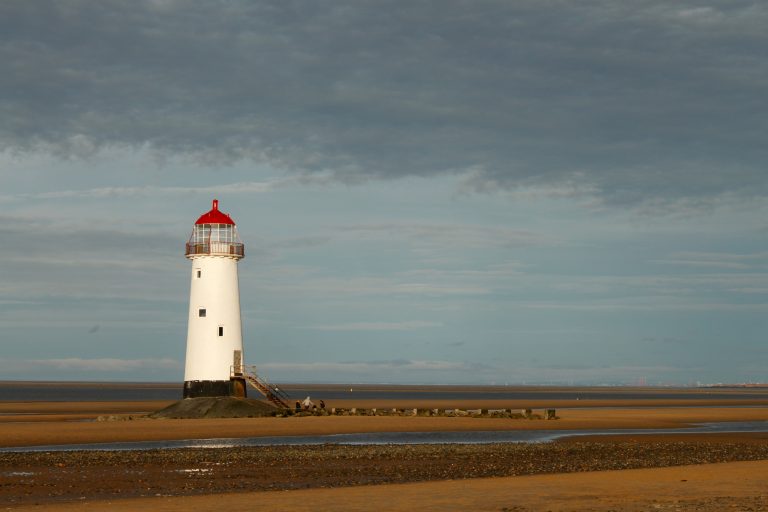
Even when the tide is out, there are still some pockets of pooled water left higher up the beach, so you might have to find a path around these if you choose to go along the beach. There’s about 6-7km of beach to cover on this stretch (depending on how far out from the coastal path you walk). Eventually you will reach Talacre Beach, home to the historic Point of Ayr Lighthouse. Once you’re level with the lighthouse, take one of the paths to the right leading off the beach and you’ll eventually re-join Station Road, drawing the walk to a close.
What To Do After
The Point Bar and Restaurant near the start of this route is dog-friendly, and even has a little water station outside with bowls so that your pooch doesn’t go thirsty. You can also leave your car here like we did while you’re out on the walk for a small fee.
When you’re in the vicinity of Prestatyn, there are a number of options for dog-friendly places to eat. Just outside of town in the village of Gwaenysgor is the Eagle & Child Inn, where you can enjoy mouth-watering food in an area of stunning natural beauty. In the town centre, there are loads of highly rated dog-friendly eateries such as the Torello Lounge, Tu Mundo, Tudor House Café Bar, and Almond Tree Café. On the front you can find the Red Boat Ice Cream Parlour, where dogs are welcome inside.
More Like This...
Edale and Crowden Clough Walk
You'll go off the beaten path on this challenging but extremely rewarding Peak District dog...
Carsington Water Reservoir Walk
This Derbyshire trail takes you all the way around the edge of Carsington Water. Along...
Lud’s Church And The Roaches Walk
You'll get to experience two of the best spots that North Staffordshire has to offer...
Long Mynd Loop from Church Stretton
This 11.6km circular takes you right into the heart of the Long Mynd in the...